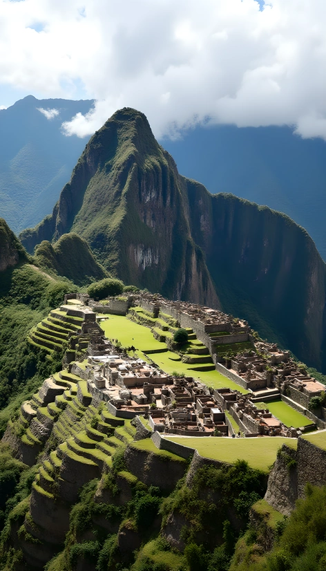
bird view map
Resize and add details
Convert to video
Outpaint the rest of the image
Additional Info
ModelFlux
Seed89004689
Enhanced Promptsatellite imaging, aerial view, overhead perspective, geographic information system data, bird's eye view, top-down layout, 3D rendering, orthographic projection, cartography, urban planning, architectural design, landscape architecture, drone footage, photorealistic textures, realistic colors, subtle atmospheric effects, real-world location, Google Maps-inspired visual style, minimalist UI elements, prominent grid pattern, clear labeling of roads, water bodies, and landmarks, shaded relief to highlight terrain features, elevation data overlaid, transparent overlays for additional information, zoomable and pannable interface, interactive hotspots for more details, night mode with starry sky and city lights, day mode with realistic sunlight and shadows, user-friendly navigation controls, adjustable opacity for transparency, customizable color scheme, web-based platform for easy sharing and collaboration, responsive design for mobile devices, high-resolution output for print-on-demand, vector graphics for scalability, export options for various file formats